Rivers and streams Property lines Property ownership
Note:
Associated with 1, 3, 4, 5
Condition:
Soiled;creased;frayed edges;faded;right 6 cm illegible
Context:
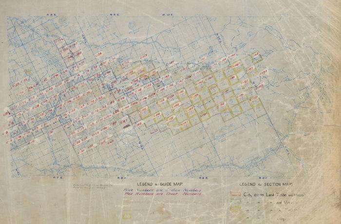
Index map for SPU Cedar River Watershed Atlas
Subject Terms:
CEDAR RIVER WATERSHEDMap
Download as 454820393
Permissions:
Photographs created by the City of Seattle are public record and do not require permission for use; please cite Courtesy of the Seattle Municipal Archives and include the identifier number. If a rights holder other than the City of Seattle exists, that information will appear in the Notes field. If you require a high-resolution file, please contact the archives archives@seattle.gov. There is an $8/scan fee for this service (see our fee schedule, here).
Citation:
Courtesy of the Seattle Municipal Archives, #2, Series 8204-02.